TAG Surveys
Drone Surveys .
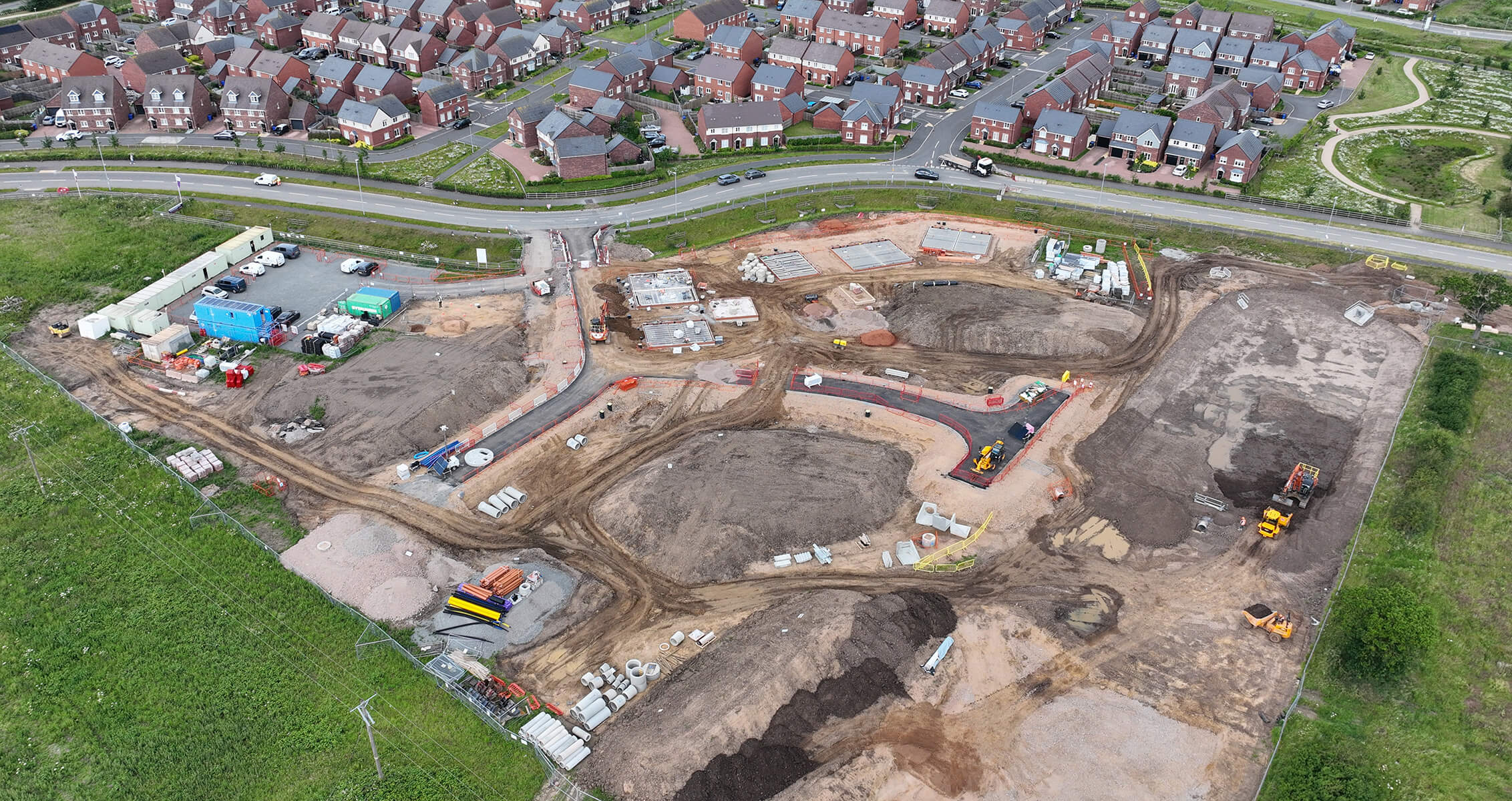
TAG uses high-specification drones and industry-leading software to deliver precise aerial data for accurate measurement, volumetric analysis, and end-to-end site monitoring.
Why use drone surveys?
Fast, accurate aerial data for precise measurement, volume analysis, and site monitoring.
Faster delivery
Capture data in hours instead of days, reducing approval delays and accelerating project timelines.
Improved safety
Keep teams off the ground while collecting accurate site data.
Flexible outputs
Support bidding, design, planning, and construction workflows with clear 2D and 3D visualisation for confident decision-making.
Ongoing insight
Repeat surveys track site changes over time, enabling accurate cut-and-fill calculations and progress validation through to final handover.
DRONE SURVEYING SERVICES
Topographical Surveys
ACCURATE TERRAIN DATA FOR SMARTER PROJECT PLANNING.
Drone-based photogrammetry captures detailed information on natural and man-made features, creating an accurate 3D model of the terrain, including elevations and contours.
As-Built Surveys
VERIFY AND DOCUMENT COMPLETED CONSTRUCTION WITH PRECISION.
Detailed 3D site data captured with drones enables accurate As-Built surveys to compare finished structures against design plans — safer, faster, and fully remote.
Progress Monitoring
TRACK CONSTRUCTION PROGRESS WITH ACCURACY, SPEED, AND SAFETY.
Drones and 3D photogrammetry capture real-time site data, enabling precise progress monitoring, plan comparisons, and informed decision-making — all remotely.
Stockpile Surveys
PRECISE CONSTRUCTION INSIGHTS, DELIVERED REMOTELY IN REAL TIME.
TAG delivers fast, accurate stockpile measurements using drone photogrammetry — safer and more efficient than traditional surveys. Measure volumes, distances, heights, generate contours, annotate, and track assets in one platform.
3D Modelling Inspection
SMARTER TOOLS FOR CONSTRUCTION MONITORING AND DECISIONS.
3D modelling inspections use drone-captured imagery to create accurate digital models for detailed site analysis and assessment — enabling remote inspections without the need for physical site visits.
CAD Overlays
ENHANCE EFFICIENCY ACROSS DESIGN, PLANNING, BUILD, AND COMPLETION.
Overlay 3D photogrammetry with CAD files to visualise designs alongside real-time site data. Measure, annotate, and track volumes, distances, heights, contours, and equipment — all in one platform.
Cut and Fill Analysis
BOOST EFFICIENCY, ACCURACY, AND SAFETY IN SURVEYING AND ANALYSIS.
Drones equipped with LiDAR or photogrammetry perform cut and fill calculations, delivering precise earthwork data faster and safer than traditional methods.
Aerial Photography & Videography
CAPTURE STUNNING AERIAL VISUALS FOR INSIGHT AND DOCUMENTATION.
Drones provide high-resolution photography and videography of construction sites, delivering clear visual data for reporting, marketing, and project analysis — safely and efficiently.
Shape the future with us
Please do not hesitate to call or send an email, our team is happy to discuss your requirements.